Lookout Mountain (LO site), Tulare County, California, Elev. = 9740 ft.
Located in Sequoia National Forest
|
Lookout Mountain (LO site), Tulare County, California, Elev. = 9740 ft.
Located in Sequoia National Forest |
||||||
|
||||||
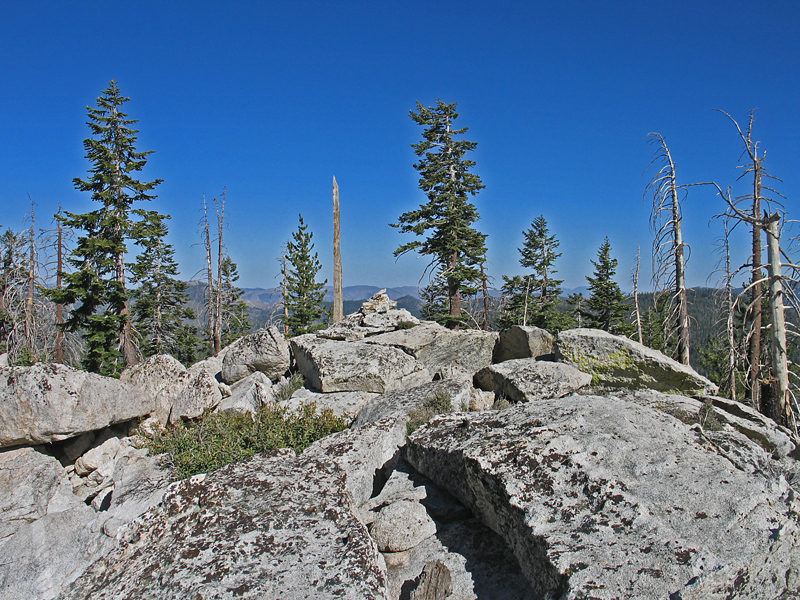
| This view shows the summit area of Lookout Mountain. There may have been a lookout here around 1937, but there is no evidence of any structure at the summit. Photo taken June 22, 2013. | ||||||
| Lookout Mountain is a simple hike and well worth the effort. From the junction near the Blackrock Ranger Station go west on Sherman Pass Road for 11.1 miles and turn right toward Bonita Meadows. There is a sign marking this intersection. The dirt road is fairly good, but high-clearance may be needed. Reset your odometer and note the following junctions: After the meadows in about 1.5 miles go left at a junction at 2.3 miles. At 3.4 miles go straight at another junction on your left. At 3.8 miles reach a T junction and go right. At 4.1 miles go left and you will reach the end of the road near Danner Meadow in 4.6 miles. There is good camping here on flat ground. From here the peak is about 0.8 miles. Go west up through an open forest. You will go slightly southwest and stay on a ridge to the top. The gain is about 950 feet. The drive and hiking route are on the Bonita Meadows 1:24,000 scale topo map. For the larger area the AAA Tulare County map is a good reference. | ||||||