|
|
|
|
|
|
Sierra la Laguna, Baja California Sur, Mexico
Reserva Biosfera Sierra la Laguna
|
|
 |
|
|
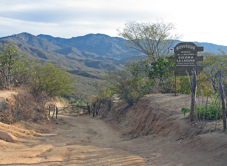
This is the entrance to the hike into the Sierra la Laguna from the west side. This trailhead is about 12 miles east on a good dirt road from Highway 19. Turn left off the main highway two miles south of the town of Todos Santos. |
|
|
|
 |
|
|
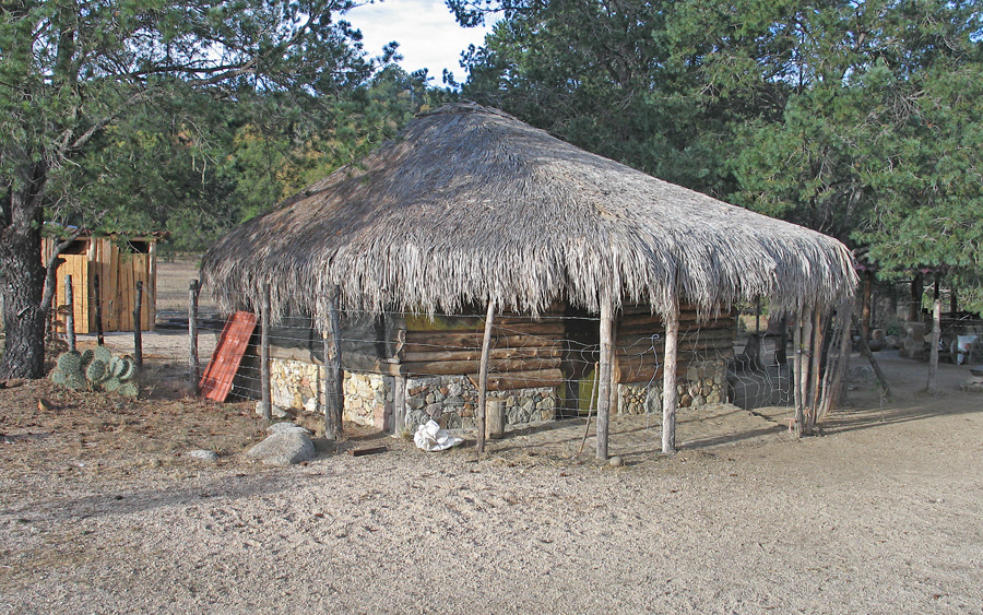
| The Ranger's hut on the edge of the large, mostly dry meadow in the high country at 5750 ft. No one was there at the time of our trip, Feb. 13, 2009. |
|
 |
|
|
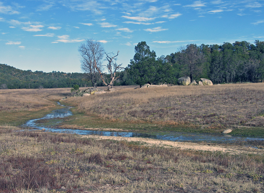
| There was some water in the high meadow as we hiked toward the highpoint. The meadow and forests are very pretty with many large oak trees. |
|
 |
|
|
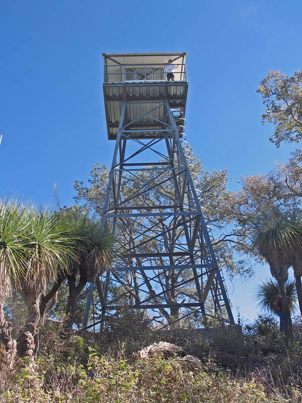
| The Fire Lookout Tower at the highpoint at 6815 ft. The tower was built around August 1, 2007. There was no equipment inside the tower.
Sierra La Laguna, article by Chris Humphrey in the spring 1995 issue of Summit magazine. This is a good article with useful information. (pdf file, 2.2 megs)
A GPS waypoint file is available: LaLaguna.gpx
|
|
|
|
 |
|
|
|
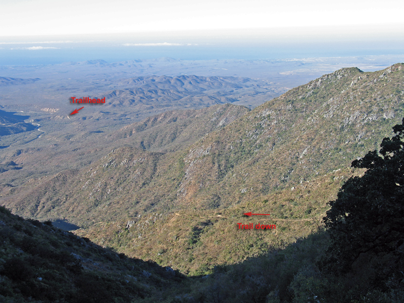
Looking down from the plateau. It is about 3000 ft. down to the trail along the valley floor. |
|
|
 |
|
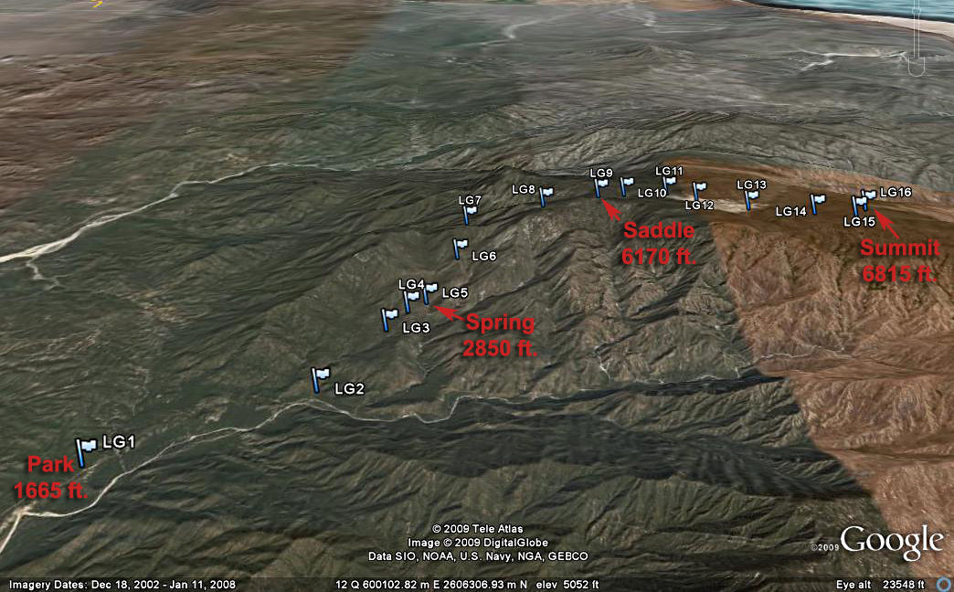
| Google Earth Image of our route to Sierra la Laguna highpoint. From LG1 to LG2 the trail is a road. At LG2 the trail starts up steeply and reaches a minor crest at LG4 then descends to a spring at LG5. The plateau is reached at LG8 and another crest at LG9. Camping is possible at LG10, the first minor meadow with water or at LG11, the main meadow. At LG13 the trail leaves the meadow and climbs up in the forest. The last part of the trail is overgrown and harder to follow from LG15 to the summit. |
|
|
|
|
|
|
|
|
|
|
|
|
|
|
|