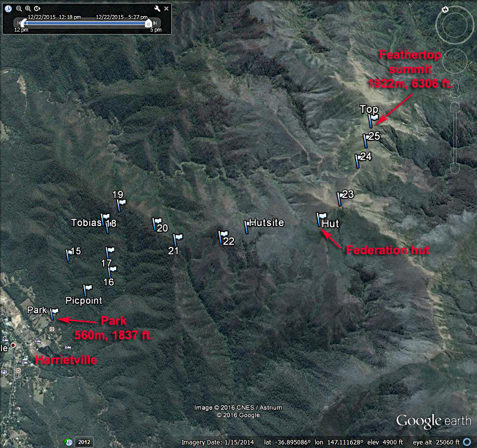
Mount Feathertop, Victoria, Australia
In the Alpine National Park 6306 ft., 1922 meters |
|||||||||||||
![]() |
|||||||||||||
A Google Earth view looking north at the hiking route to Feathertop summit which starts near the town of Harrietville. In the town just north of a bridge over the Ovens River, turn east onto a road called the Feathertop Track. Follow this for about one km to the signed trailhead. The trail is very good all the way. In 2 km you will reach a viewpoint called Picture Point and Tobias Gap in another 2 km. The Federation Hut is reach after about 8.5 km. Past the hut the trail goes over a saddle at point 23 then makes a final climb up the Razorback. The route is 21 km (13 miles) round-trip with a gain of about 1360 m (4470 ft.). It took us about 4 hours and 10 minutes to reach the top. 12/15 RLC | |||||||||||||
![]() |
![]() |
||||||||||||
The Federation Hut which was rebuilt after burning down in the January 2003 fires. | |||||||||||||
Looking east from a saddle at point 23. The trail climbs up the Razorback to the barren summit. | |||||||||||||
![]() |
|||||||||||||
Notes: A good map for this hike and the surrounding area is called: Bogong Alpine Area, 3rd edition, 1:50,000 scale by Spatial Vision Co. The map has a one-kilometer UTM grid in Zone 55. Set your GPS receiver to use the Australian GDA94 datum. I found the error to be small using WGS84.
This map can be ordered by mail from: Mapworks, 184 Keilor Road, North Essendon, VIC 3041. http://www.mapworks.com.au/ A GPS waypoint file of the above route is at: MtFeathertop.gpx The book: Bushwalking in Australia by John and Monica Chapman, 4th edition, has a lot of information on hiking Feathertop. See pages 194 to 203. The authors have a website on this and other books: http://www.john.chapman.name |
|||||||||||||
The summit of Feathertop which I believe is the furthest east of similar height tops. | |||||||||||||