|
|
|
Mount Bogong, Victoria, Australia
In the Alpine National Park, highest point in Victoria state
Elevation = 6516 ft., 1986 meters
|
|
|
|
 |
|
|
|
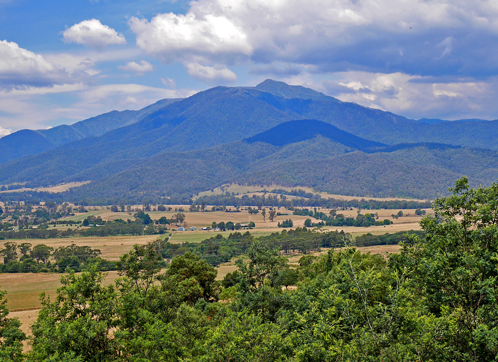
Looking
east at Mt. Bogong from the viewpoint on highway C531 about 4km north
of the town of Mount Beauty. A popular trail is on the north side up a
route called The Staircase. To reach the trailhead take the Mountain
Creek Road east from C531. This road is about 1.5 km north of the
lookout spot or about 5.5 km north of the town. Drive in 10 km to the
campground by a stream. The place has a few picnic tables and toilets,
but no potable water. There is no fee. |
|
|
|
 |
|
|
|
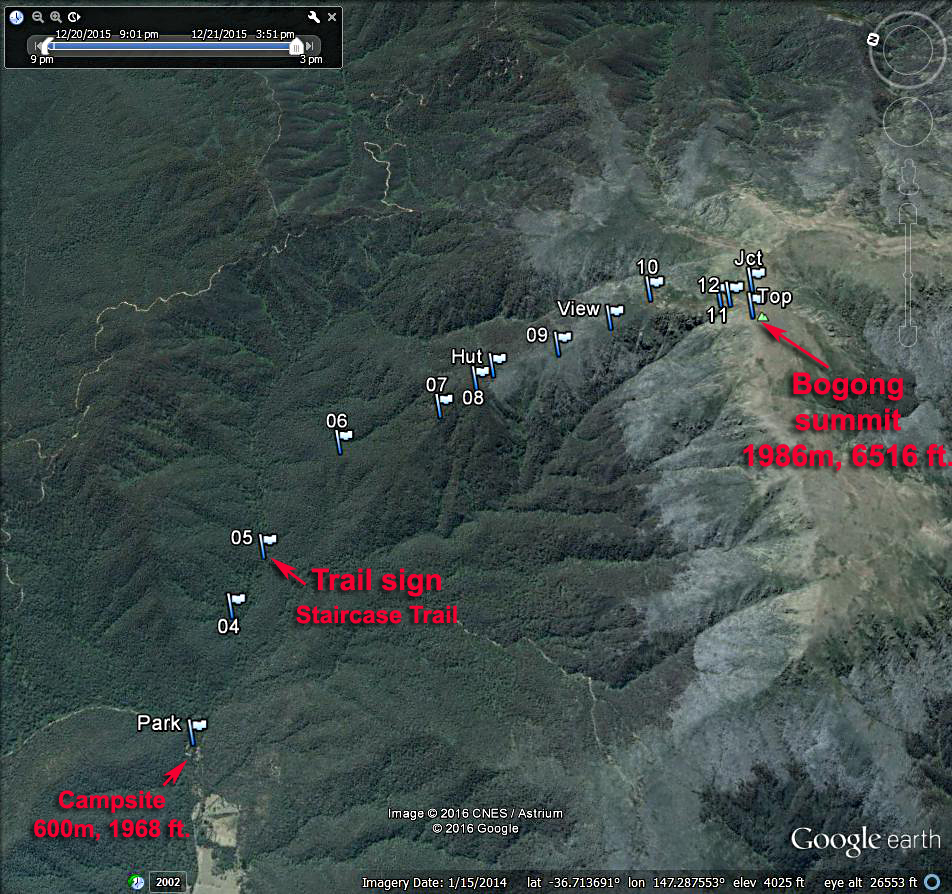
A
Google Earth view of the route to Bogong summit. From location Park,
which is the camping area, walk about 3 km east on the dirt road to the
sign for the staircase trail. This road can be driven in a
high-clearance vehicle. It has several stream crossings. The trail
climbs up to the bivouac hut which has water and a solar toilet. Then
more steep sections to a viewpoint and memorial cairn. At point JCT on
top of the high ridge go right (west) to the large summit cairn. This
route is 17 km (10.5 miles) round-trip with a gain of about 1386 m
(4550 ft.). It is easy to follow and took us four hours to reach the
top and two hours 50 minutes to descend. Younger hikers can probably do
the ascent a lot faster. 12/15 RLC |
|
|
|
 |
|
 |
|
|
|
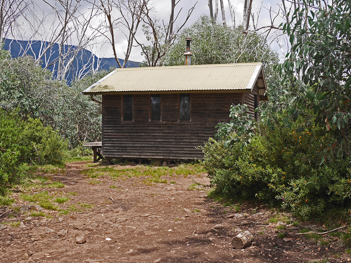
The bivouac hut which is open but intended only for emergency use. There is rainwater in a tank on the side of the building. |
|
|
|
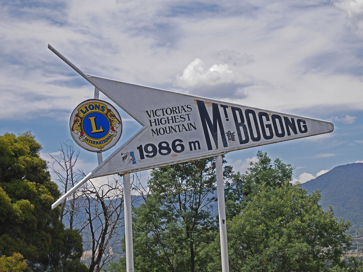
Sign at the highway view point. |
|
|
|
 |
|
|
 |
|
|
|
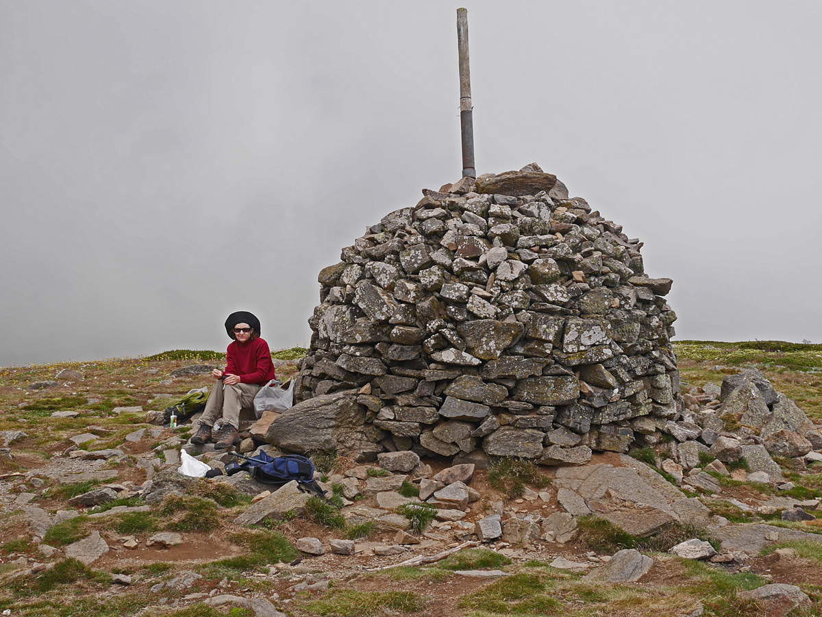
Shelley at the large summit cairn with clouds rolling by. Fortunately, it was not very cold and it didn't rain. |
|
|
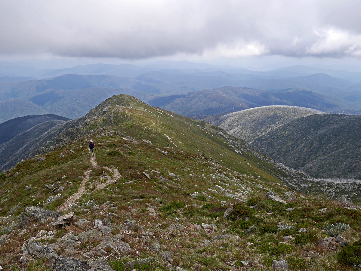
A view of the trail looking north at about point 12. |
|
|
|
Notes:
A good map for this hike and the surrounding area is called: Bogong
Alpine Area, 3rd edition, 1:50,000 scale by Spatial Vision Co. The map
has a one-kilometer UTM grid in Zone 55. Set your GPS receiver to use
the Australian GDA94 datum. I found the error to be small using WGS84.
This map can be ordered by mail from: Mapworks, 184 Keilor Road, North Essendon, VIC 3041. http://www.mapworks.com.au/
A GPS waypoint file of the above route is at: MtBogong.gpx
|
|
|
|
|
|
|
|
|
|
|
|
|
|
|
|
|
|
|
|
|
|
|