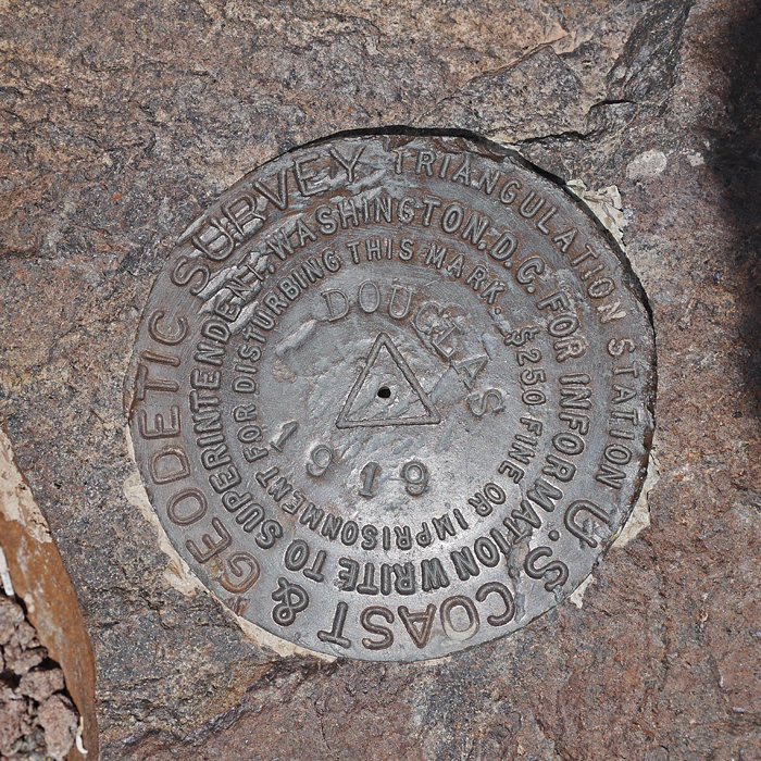
In Petrified Forest National Park, Elevation = 6243 ft., 1903 meters
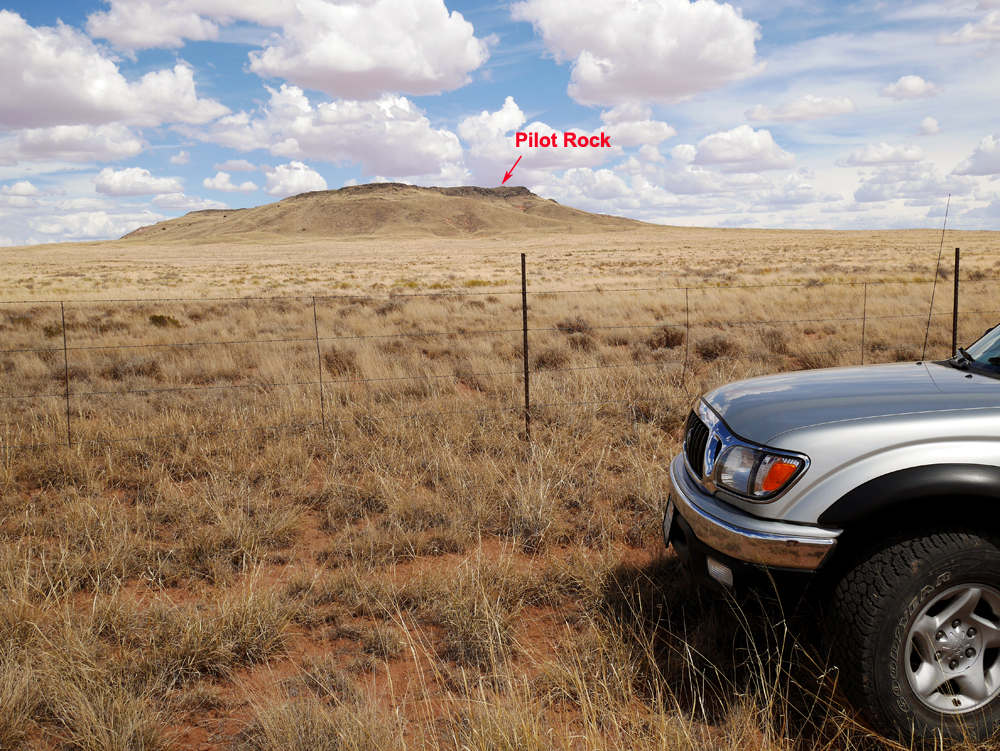
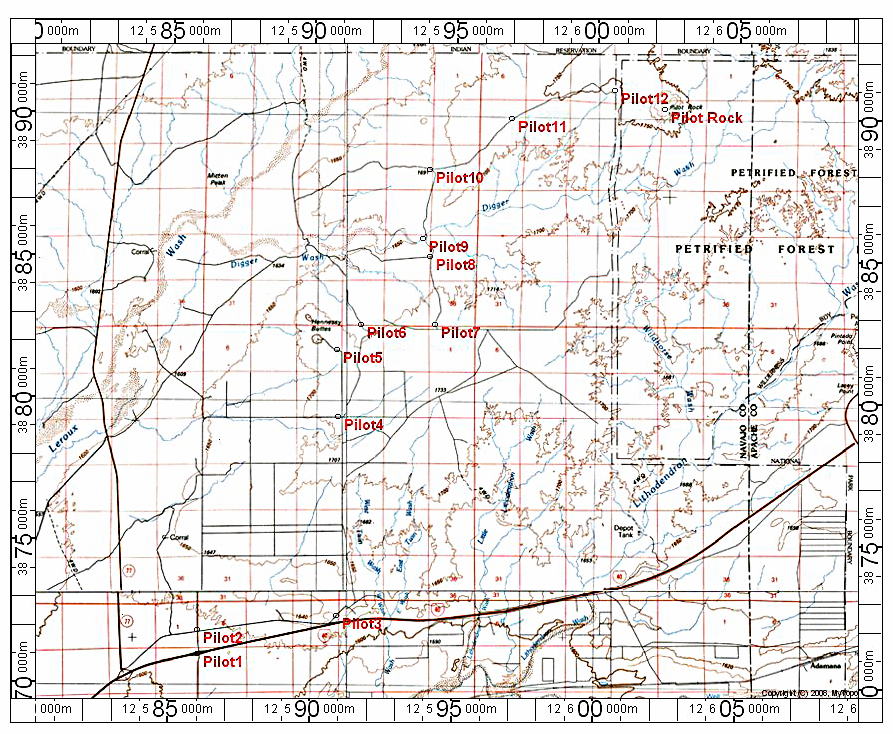
Described here is a driving route to the northwest boundary of the park which will get you to within about one mile of the peak which can then be reached by an easy hike. The drive is 20 miles and a four-wheel drive vehicle is needed. The road should not be attempted after recent rains. The drive may cross some private property, but at the time (July 2014) there were no restrictive signs.
Driving Directions: Leave Interstate 40 at exit 294 at a small, scattered community of Sun Valley. Zero your odometer and note the following points:
0.0 miles at I-40 exit 294, go north
0.5 turn right onto Pima St., drive east. Continue past some homes as the road goes close to the Interstate.
3.5 go left onto Coyote Road which soon turns into Sheri Road.
8.0 continue straight north at Cash Lane which crosses
9.5 open a gate marking state land. In about 50 feet turn right onto a worse road.
10.3 the road goes through a dip with an opening in an east-west fence line. Continue east along fence.
10.9 drive over graded berm forming a cattle pond
11.7 open a gate, continue east
12.1 turn north at junction
13.7 stay right as a road joins from the left
14.2 drive by cattle tank. Cross sandy arroyo, road may be difficult to follow here, and continue north.
14.8 drive up a short, steep hill
15.8 go right at junction
17.9 stay to the left at a junction
20.5 reach north-south fence line that is the park boundary
Hiking Directions: The peak is an easy hike of about 1.3 miles with a gain of about 500 feet. A large cairn marks the highest point at the southern end. The benchmark disk is close by west of the cairn. Look for a register in the cairn. PilotRock.gpx (A GPS file with points corresponding to above mileages)