Located in the Cabeza Prieta National Wildlife Refuge
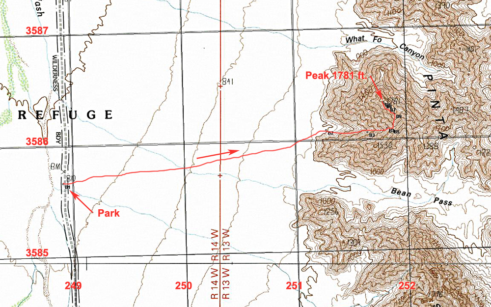
Driving Directions: The peak is at the north end of the Sierra Pinta, a 20 mile long range of mountains in the central part of the Cabeza Prieta Wildlife Refuge. The most direct driving route is to drive south from Tacna. On Interstate 8 east of Yuma use exit 42 in Tacna. This is Ave. 40E which runs north and south. On the south side of the Interstate take the unmarked dirt frontage road that goes along the fence and then heads east. Take this wide, graded dirt road east for 6.0 miles and then turn right. There is a sign here indicating the start of the Barry M. Goldwater Air Force Range. Reset your odometer at the turn and head south on this road across the broad Mohawk Valley. After 23.1 miles there is a sign marking the Refuge boundary. Continue straight ahead on the road which narrows and becomes more sandy where four-wheel drive is needed. From the Refuge boundary point B1 is 2.5 miles south.
Notes on Permits for the Barry M. Goldwater Range and Cabeza Prieta Wildlife Refuge: This peak is in the Cabeza Prieta Wildlife Refuge. Public entry for hiking and camping is allowed with a permit from the Refuge office in Ajo which regulates public entry. The permit will also allow you to drive across the Barry M. Goldwater Range to reach the Refuge. For information write or call the Refuge staff at: 1611 North Second Ave., Ajo, AZ. 85321. Phone: (520) 387-6483. Four-wheel drive vehicles are required. More information on permits is at my site: Cabeza Permits Note: Before driving in call the BMGR office in Yuma at: 800-979-0657.
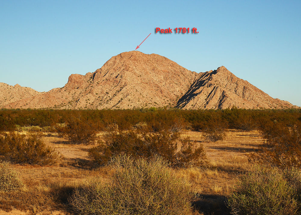
Hiking Notes: Walk east across the flat desert to the base of the mountain and the prominent canyon at point B2. Head up the canyon to the saddle at the lowest point on the ridge at point B5. Go north along the ridge staying on ledges on the east side. Near the top you will want to traverse northwest going along under some rougher parts of the ridge. The last part is easy scrambling to the summit. This route is 4.4 miles round-trip with a gain of about 1000 ft. The climb took us 1 1/2 hours 11/14 RLC