Located in the Barry M. Goldwater Marine Corps Test Range
At the south end of the Vokopi Ridge
Notes on Permits for the Barry M. Goldwater Range and Cabeza Prieta Wildlife Refuge: This peak is on the Barry M. Goldwater Range, West Side. Public entry for hiking and camping is allowed with a permit from the Cabeza Prieta Wildlife Refuge office in Ajo which regulates public entry. The permit will also allow you to drive across the Barry M. Goldwater Range to reach the Refuge. For information write or call the Refuge staff at: 1611 North Second Ave., Ajo, AZ. 85321. Phone: (520) 387-6483. Four-wheel drive vehicles are required. More information on permits is at my site: Cabeza Permits Note: Before driving in call the BMGR office in Yuma at: 800-979-0657.
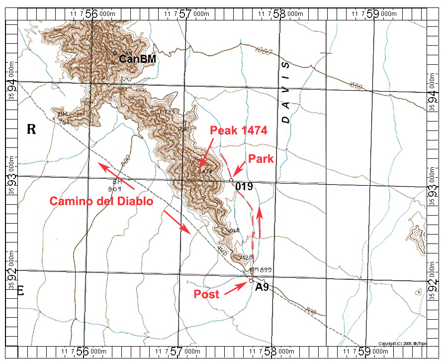
Driving Directions: Take exit #14 on Interstate 8 which is Foothills Blvd. on the far eastern side of Yuma. Drive south to the end of the pavement which is Post "A" and the Range boundary. Be sure to have a full tank of gas and adequate water and supplies since there are no facilities in this large area. Note the following mileages starting from Post A at the boundary:
At 4.1 miles reach Post A2 and go left.
At 7.5 miles go left at a junction at Post A5.
At 9.6 miles go right at Post A6. This road is the old Camino del Diablo.
At 10.9 miles pass by Post A7.
Stay on the Camino heading southeast until you reach Post A9 at 17.7 miles. Turn sharp left here onto a sandy track heading north. Drive about 0.8 miles and park.
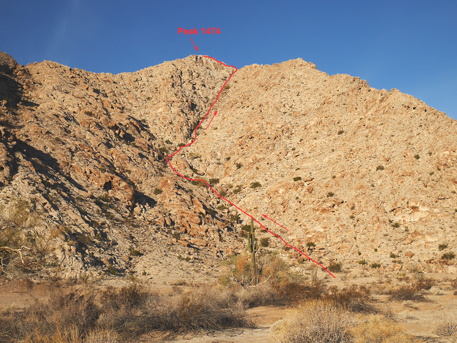
Hiking Directions: Go west up the canyon and follow the drainage shown in the picture above. The distance is very short, less than one-half mile, and the gain is about 530 feet. The climb takes about one-half hour to the summit. 12/14 RLC